Document the building once.Every decision after that uses it.
One planned capture. One reviewed record. Every later service — tax, insurance, capital planning, construction — reads from the same record instead of measuring your building again.
Two written commitments. The quoted price is the price for the scope you accept, and if a released deliverable misses the accuracy specification printed on it, we re-capture and re-issue at no charge. Read the terms.
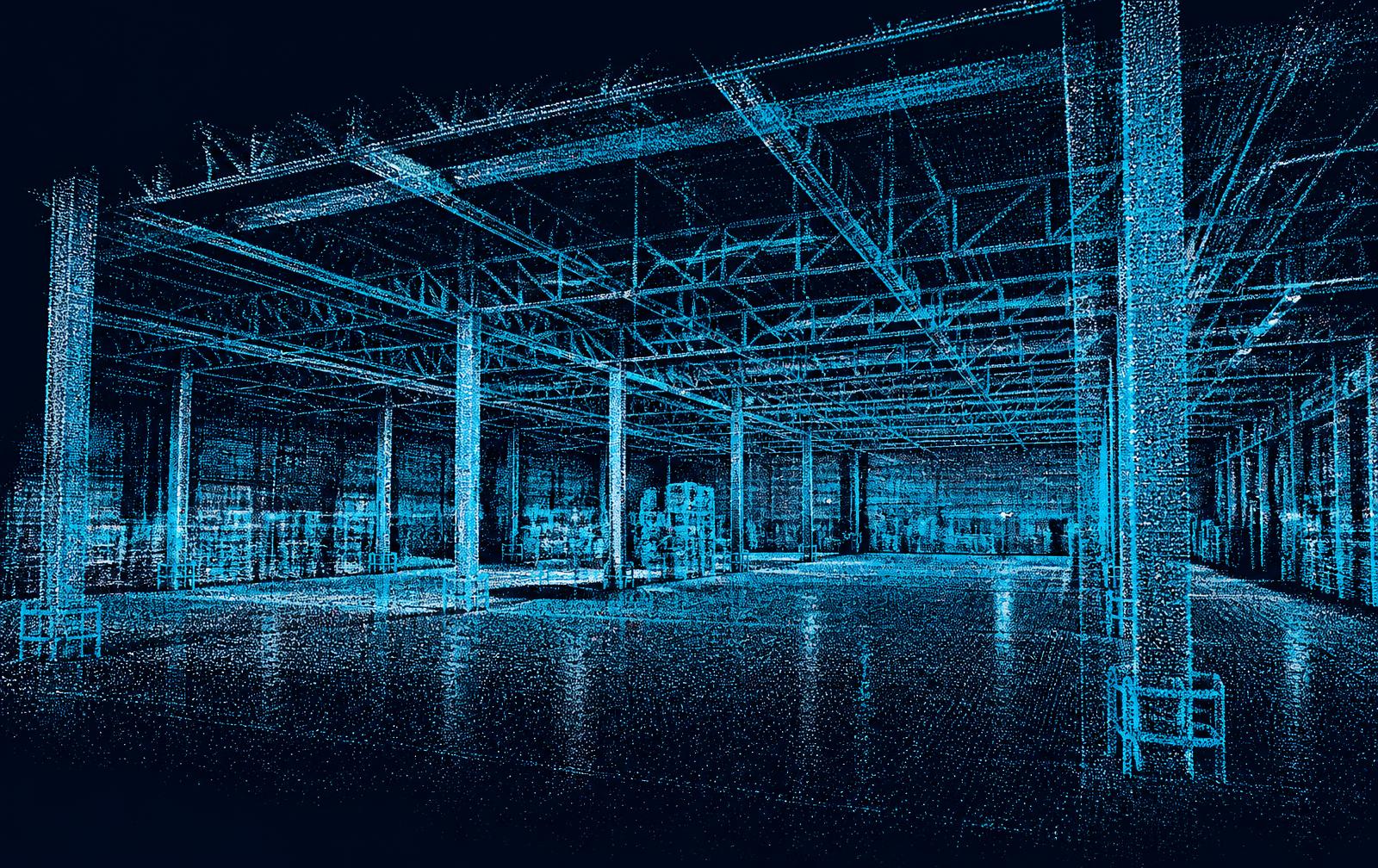
Interior spatial capture, indexed to the same record every later service reads from.
- Five named scopes
- One calculation rule, no ranges
- ±2 in or ±1 in by scope
- Class stated on the deliverable
- 5–21 days by scope
- After the capture visit
- 60 road miles
- Beyond that, mileage itemized
The building is captured
One mobilization, scoped against every use you can foresee.
The record is produced
Spatial, visual, asset, condition and provenance layers, reviewed before release.
The next service activates
Later work draws on the same record. No second visit to re-measure.
We are new. So we published the rules instead of asking for trust.
No client logos, no case-study counts, no testimonials — we will not manufacture them. What follows is checkable before you speak to anyone.
Named hardware, published specifications
Every capture device is listed by model with its manufacturer-published specification and what that tolerance means for the deliverable. Confirm the figures with the manufacturer, not with us.
The field-to-delivery procedure is published
Each service publishes its field steps, processing steps, quality gates and the conditions that cause a deliverable to be rejected internally before release.
Five named scopes, one published rule
The scope your property falls into is decided by published limits on building count and enclosed area. The rule and the resulting price are on the page before you contact us.
A real document you can open before you buy
The sample written scope uses the same language, structure and fixed-price format as a live engagement. Read it and judge the work product directly.
Documenting a property five times is the expensive option
None of this is a technology problem. It is a sequencing problem: the property gets captured for one decision at a time.
- You pay for the same building five times
- Diligence, cost segregation, insurance, capital planning and leasing each send their own vendor. Five mobilizations, five invoices, five datasets of the same walls.
- The numbers never agree
- Each vendor measures differently and states nothing about method. When two square-foot figures disagree, someone has to re-measure — usually at the worst moment in the deal.
- The evidence is gone when you need it
- A claim, a dispute or a capital request asks what the property looked like on a specific date. Photos live in phones and inboxes, unlocated and undated.
- Every new question restarts the clock
- A question that could be answered from an existing record instead becomes a new scope, a new schedule and another site visit.
Find the service by the decision in front of you
Select a lifecycle stage to see which services activate against the property record.
Underwrite, diligence and document a property before capital is committed.
Property Intelligence Baseline
The flagship capture-once engagement that establishes a property's authoritative digital record — the Property DNA every downstream service draws from.
Cost Segregation Evidence
Measured, photo-linked documentation of candidate short-life assets and site improvements that supports a CPA or cost segregation specialist's study.
Acquisition Due Diligence
Rapid, evidence-first property documentation during a diligence window so acquisition decisions rest on observed conditions rather than seller-provided material alone.
Property Intelligence Baseline
The flagship capture-once engagement that establishes a property's authoritative digital record — the Property DNA every downstream service draws from.
- One reconciled property record that downstream services can activate without recapture
- Documented spatial, visual and asset evidence with capture dates and methods
- A reusable baseline that supports tax, insurance, capital planning and construction work
- Reduced cost and schedule for every subsequent engagement on the same property
Registered point cloud
±2 in or ±1 in by scope
Indexed evidence library
Located in space and time
Structured asset registry
Attributes + identifiers
Capture record
Date, method, reviewer
Everything included in a Baseline engagement
No line item here is an upsell. This is what a baseline engagement delivers before any additional service is activated.
Scoping session against your actual decision
We start from what you have to decide, then work backwards to the accuracy and evidence that decision needs.
One planned capture of the whole property
Aerial, interior, site and detail capture executed in a single mobilization, scoped for every use you can foresee.
Measured schedules with the method stated
Areas, lengths and counts released with the method, exclusions and accuracy band that produced them.
An indexed evidence library
Imagery located in space and time, linked to the observations it supports, so any figure can be checked.
QA review before release
An internal QA reviewer verifies traceability, accuracy statement and boundary language on every deliverable before you see it. Named senior sign-off is included on Complex and Campus scopes.
A record that stays yours
The next service activates against the same record. No second mobilization, no second set of numbers.
What is not included is stated just as plainly on every scope: return visits caused by denied access, sealed or certified professional work, filing fees, laboratory testing and third-party data fees.
If a released deliverable does not meet the accuracy specification stated on that deliverable, we re-capture and re-issue it at no additional charge.
Once you confirm a scope, the published price for that scope is the price invoiced. We do not re-price after the visit.
How to check us before you hire us
Each item below is verifiable against a manufacturer specification, a published standard, or a document we will hand you before any work starts.
Equipment and specification
The capture stack is listed publicly with model names and the limitations of each device stated alongside its purpose. Specifications come from the manufacturer and can be checked independently.
- Aerial capture: DJI Mavic 3 Pro Cine, with its electronic shutter and consumer GNSS stated as a limitation rather than omitted.
- Interior and selected exterior capture: Matterport Pro3 LiDAR, with exportable spatial data.
- Processing: a dedicated RTX-class workstation for photogrammetry, point-cloud processing and report generation.
- Control and verification: where a scope requires it, ground-control and registration targets, laser distance checks and RTK control are arranged for that engagement and recorded in the capture log.
- Every equipment entry on the capabilities page carries an explicit ownership status, so nothing is implied to be in hand that is not.
Method and quality gates
The procedure is documented per service rather than described in general terms. The same gates run on every engagement.
- Field steps and capture geometry are fixed before mobilization, not decided on site.
- Capture media is duplicated to a second verified copy before any card is erased, using storage arranged for the engagement.
- Processing steps, transformations and edits are recorded so a result can be reproduced.
- A deliverable that cannot be traced back to source capture is rejected internally before release.
- Accuracy band, method and intended use are printed on the deliverable itself, not on a marketing page.
Standards and open formats
Deliverables are produced in documented, portable formats so a qualified professional can inspect the underlying data with their own tools.
- Point clouds delivered as E57 and LAS/LAZ.
- Raster and mapping products delivered as GeoTIFF and GeoPackage.
- Spatial layers readable in QGIS, PostGIS and standard GIS toolchains.
- No deliverable depends on a viewer only we can open.
- Interior LiDAR exports are produced through the Matterport cloud service today; its export fees are passed through at documented cost and named on the invoice.
Accountability
Who is responsible for what is stated in advance, including where our responsibility stops.
- Legal boundary surveys, final tax positions, licensed engineering conclusions, official valuations, thermal diagnoses and legal opinions require qualified professionals. We document; they conclude.
- Deliverables are checked by a reviewer against the capture record before release.
- The published scope price does not move after confirmation.
- Exclusions are printed on the scope in the same type size as the inclusions.
We are new, and we compete on what can be checked.
Lodging Connections is a founding-stage operator. We have no client testimonials to show you and we are not going to imply otherwise. What we publish instead is the equipment by model, the procedure step by step, the standards each deliverable is produced against, a sample document you can open right now, and a fixed price that cannot move after confirmation. Judge us on those.
- No claimed results, no borrowed logos, no unnamed "clients say" quotes.
- Founding engagements are documented in full, and published as named case studies only with written permission.
- If a deliverable misses its stated accuracy specification, we re-capture at our cost.
Capture is typically scheduled 2 to 3 weeks out
Standard service area is 60 road miles from base; beyond that, mileage is itemized
Reviewed deliverables follow the visit by 5 to 21 calendar days depending on scope (5 to 14 for single-building scopes)
These are current operating figures, not a promise. Your confirmed scope states the actual dates in writing before anything is scheduled.
One capture. Many activations.
The same reviewed record supplies tax evidence, insurance baselines, capital planning, construction documentation and marketing media.
- Aerial site, roof and elevations
- Interior spatial capture
- Thermal by arrangement where scoped
- Document intake
- Spatial
- Point clouds, surfaces, orthomosaics and derived geometry with accuracy bands.
- Visual
- Indexed imagery — aerial, interior, detail and thermal — located in space and time.
- Assets
- Structured equipment, systems and site improvements with attributes and identifiers.
- Condition
- Observations with severity flags, linked to the imagery that supports them.
- Documents
- Drawings, reports and client-supplied records attached to the property and its assets.
- Provenance
- Capture date, method, equipment, personnel and reviewer for every record.
Walk the property. Open the record behind what you see.
A navigable reconstruction of a captured property, where every hotspot resolves to a structured Property DNA record: the asset, the evidence, the capture date, the review state and the intended use.

- Hotspots bound to assets, evidence items, findings and measurements.
- Guided viewpoints prepared for a specific decision.
- Capture-over-capture comparison where a property is captured more than once.
- Indicative measurements presented with control method and accuracy class.
- Review state shown on the record, never implied by the visualization.
A visual reconstruction supports understanding and planning. It is not a boundary survey, an engineering conclusion, an official valuation or a legal opinion.
An engineering stack, not a marketing stack
Capture, processing and structuring methods are stated on every deliverable so a qualified professional can judge fitness for their own scope of work.
- Aerial photogrammetry
- Structured flight capture producing orthomosaics, surfaces and measurable reconstructions.
- LiDAR & point cloud
- Registered point clouds for interior and exterior spatial measurement at a documented accuracy band.
- Thermal imaging
- Radiometric capture used to locate apparent anomalies for qualified follow-up. Delivered by arrangement until an owned radiometric payload is listed on the equipment page.
- Digital twin assembly
- Navigable spatial models tied to the property record and its asset registry.
- AI-assisted extraction
- Model-assisted detection and structuring of assets and quantities, always confirmed by human review.
- Evidence graph
- Every measurement, observation and deliverable links back to the source capture that produced it.
Eighteen services, one record
Every service activates against the same Property DNA record. Status pills show what is deliverable today, what is arranged per engagement, and what is delivered with a named professional partner.
Financial & Tax Evidence
Transaction & Risk
Acquisition Due Diligence
Rapid, evidence-first property documentation during a diligence window so acquisition decisions rest on observed conditions rather than seller-provided material alone.
Insurance Pre-Loss Baseline
A dated pre-loss record of building, contents and site condition so that after an event there is documented evidence of what existed beforehand.
Construction & Capital
Construction Progress Intelligence
Recurring aerial and interior capture that documents as-built progress over time and supports draw, schedule and change discussions with dated evidence.
Property Condition and Capital Planning
Documented condition observations across building systems and site, organized to support capital planning and reserve discussions with qualified professionals.
Renovation Scope and Bid Packages
Existing-conditions documentation and measured quantities assembled into a clear scope package so renovation bids are comparable and grounded in reality.
Operations & Digital Twin
Facility Digital Twin and Asset Registry
A navigable spatial model of the facility paired with a structured registry of equipment and assets, linked to imagery, location and supporting documents.
Campus and Municipal Asset Intelligence
Multi-building and site-wide documentation for campuses and public agencies, producing a shared asset and condition record across many properties.
Industrial and Warehouse Intelligence
Documentation of industrial facilities including clear heights, rack layouts, dock configurations, floor conditions and production equipment.
Measurement & Field
Roof and Building Envelope Documentation
Measured roof and facade documentation with high-resolution imagery, supporting repair scoping, warranty discussions and capital planning.
Stockpile and Earthwork Measurement
Aerial volumetric measurement of stockpiles, cut and fill, and earthwork progress with a documented method and stated accuracy band.
Solar and Thermal Inspection Support
Aerial thermal and visual capture across solar arrays and building envelopes that identifies apparent anomalies for qualified professional follow-up.
Documentation & Communication
Disaster and Claims Documentation
Rapid post-event capture that documents observable damage and, where a baseline exists, supports before-and-after comparison.
Litigation and Dispute Evidence
Carefully documented capture with chain-of-custody discipline, produced for use by counsel and retained experts in construction and property disputes.
Emergency Preplanning
Spatial documentation of buildings and sites organized for first responders, safety teams and emergency planners.
Historic Preservation
High-fidelity documentation of historic fabric and detail, preserving a measured record of a structure as it exists today.
Marketing, Leasing and Remote Tours
Presentation-grade imagery and navigable tours generated from the same capture that powers the property's technical record.
Documentation shaped to your sector
The record is the same. The scoping, taxonomy and reporting are not.
Investors & Owners
Underwrite, hold and reposition assets from one property record instead of a folder of disconnected reports.
Construction & Developers
Document what was built, when, and in what sequence — with evidence available before conditions are covered.
Lenders & Credit
Independent, dated documentation of collateral condition and construction progress across the loan lifecycle.
Universities & Schools
Bring decades of scattered building records into one consistent, phased documentation program.
Healthcare
Document complex, continuously occupied facilities without disrupting clinical operations.
Municipalities & Public Agencies
Defensible, transparent documentation of public buildings, sites and infrastructure surfaces.
Manufacturing & Warehousing
Verify the physical reality of industrial space before committing to layout, automation or lease decisions.
Landlords & Multifamily
One capture that serves capital planning, insurance documentation and leasing media across the portfolio.
Insurers & Claims
Dated pre-loss baselines and rigorous post-event documentation to support the claim file.
CPAs & Cost Segregation Firms
A measured, photo-linked evidence layer beneath the studies your firm signs.
Architects, Engineers, Surveyors & Contractors
Existing-conditions capture delivered in the formats your teams already work in.
Churches & Nonprofits
Practical, budget-aware documentation for volunteer-led property committees and stewardship planning.
Hotels, Retail & Hospitality
Document brand-standard conditions, renovation scope and guest-facing spaces from a single capture.
Renewable Energy
Array-scale thermal and visual documentation, site progress capture and asset records for energy sites.
Professional review
Professional boundaries
- Legal boundary and property line determinations require a licensed land surveyor.
- Final tax positions, asset lives and depreciation treatment require a qualified tax professional.
- Structural, mechanical and other engineering conclusions require a licensed engineer.
- Official valuations and appraisals require a licensed appraiser.
- Thermal imagery indicates apparent anomalies only and is not a diagnosis.
- Legal opinions, causation findings and expert testimony require qualified counsel and retained experts.
How an engagement runs
- 01
Consultative scoping
We start from the decision you need to make, then work backwards to required accuracy, evidence and intended use.
- 02
Capture planning
Access, airspace, safety and sequencing planned before anyone mobilizes.
- 03
Field capture
Aerial, interior and ground capture executed once, to the scope every downstream service will draw on.
- 04
Processing & structuring
Registration, reconstruction, measurement extraction and AI-assisted structuring into Property DNA.
- 05
QA review
An internal QA reviewer verifies traceability, accuracy statements and boundary language before anything is released.
- 06
Activation
Deliverables publish to your workspace and remain available for the next service without recapture.
Where the record lives
Technical deliverables, evidence and review live in the Property Intelligence workspace. CRM, proposals, contracts, billing and project status live in SuiteDash.
- Client property workspace
- Property timeline
- Asset registry
- Deliverables library
- Professional review queue
- Admin operations dashboard
- Field capture checklist
Demo-only previews using typed mock data.
Capacity under your professional direction
CPAs, engineers, architects, surveyors, adjusters and counsel use our capture and processing capacity inside their own scope of work. Conclusions remain theirs.
Published scopes. Exact prices. No negotiation theatre.
Every service publishes five named scopes, the property limits that decide which one applies, and the exact calculation rule. Multi-property orders price each property from its own facts, then add the subtotals.
- Baseline Engagement
- A single-property capture-once engagement that creates the Property DNA record and its first deliverable set.
- Service Activation
- Add a specific service — tax evidence, capital planning, envelope documentation — to a property that already has a baseline.
- Portfolio Program
- A phased, multi-property program with a consistent taxonomy, recurring capture cadence and roll-up reporting.
- Professional Partner
- Capture and processing capacity for CPAs, engineers, architects, surveyors and claim professionals working under their own scope of work.
Common questions
Three steps from here to a reviewed property record
Tell us about the property
A short form: location, type, size, and the decision in front of you. Under five minutes, no account required.
Get the scope and the exact price
We match the property to a published scope and send the number the rule produces, with inclusions and exclusions in writing.
Approve, capture, receive the record
One visit. Reviewed deliverables published to your workspace, typically within 5–14 days of the completed visit for single-building scopes, up to 21 for campus scopes.
Start with the decision you need to make.
Tell us the property and the decision. You get a written scope with an exact price before anything is scheduled.